
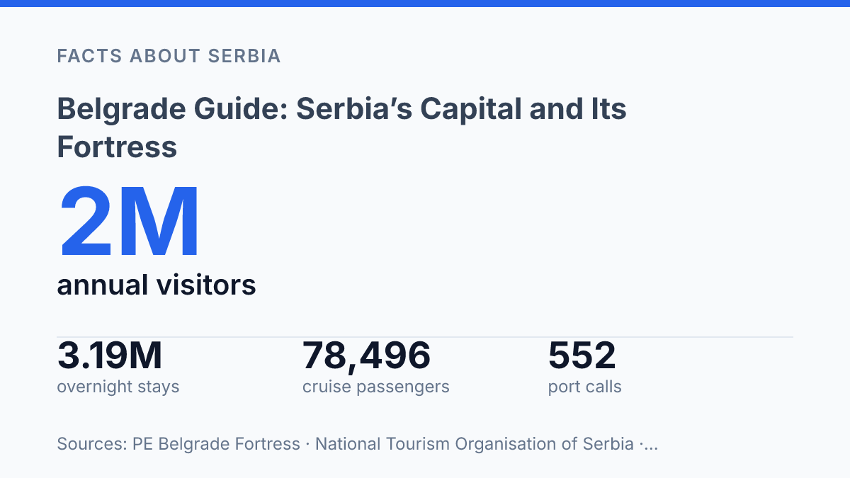
Belgrade still works like a border machine: in 2024, its river terminal recorded 552 cruise calls and 78,496 passengers stepping off at the Sava–Danube confluence.
That number matters. The view from the fortress isn’t only pretty.
It shows why armies, traders, cruise ships, and weekend visitors keep choosing the same bend in the map. Serbia sits on Corridor X and the Rhine-Danube route, with 1,677 km of navigable waterways tying the capital to a much larger European system.
But the real surprise is how much life sits inside the old defensive shell. Kalemegdan holds Roman traces, museum rooms, monuments, a zoo, lawns, and lookout points across more than 60 hectares. In my honest opinion, Treat it as a park and you’ll miss the point. This guide connects the rivers, the fortress. The modern city they still shape.
Why Serbia’s capital sits at a strategic crossroads
Two rivers and two continent-scale transport corridors explain why Belgrade has never been just another capital on the map. It is Serbia’s political center and its largest urban area, so national power, transport, migration, and tourism all concentrate here first. That scale matters.
In a country where geography still shapes daily life, the capital doesn’t sit at the edge of the story. It sits in the middle of the route.
The key is the meeting of the Danube and Sava rivers. Budapest has the Danube as its grand central axis, and Bratislava uses the same river as a border-facing advantage. Serbia’s capital gets something more complicated: a confluence. One river links Central Europe to the Black Sea.
The other pulls traffic, trade, and movement in from the western Balkans. Put them together. The city becomes a hinge rather than a stop.
Modern infrastructure still follows that old logic. As the Government of Serbia states in 2026, Serbia sits where Corridor X meets the Rhine–Danube Corridor, with 1,677 km of waterways and inland transport on the Danube, Sava, and Tisa.
That number isn’t trivia. It explains why roads, rail lines, river routes, and political attention keep converging near the same place.
In my view, the city looks open and easy to read on a map, but its location has always made it a target as much as an asset. Access brings commerce.
It also brings pressure. That is the central tension behind its importance: the same geography that connects Serbia to Europe has also exposed its capital to every power that wanted control over the route.
Beogradska Tvrđava and the power of the rivers
The best view from Beogradska Tvrđava is also the reason armies refused to leave it alone. From the upper ground, the two rivers spread below like a map you can control. Whoever held these walls could watch movement on water, road, and frontier at once.
That’s why Beogradska Tvrđava is the city’s most important landmark, not just its most photographed ruin. The fortress and park cover over 60 hectares, according to the managing public enterprise for the complex, but scale isn’t the real point. Its authority comes from height, visibility, and command.
The Roman layer began with Singidunum, a legionary base whose fortified core measured roughly 560 m by 330–380 m, enclosing about 20 hectares, according to UNESCO’s Danube frontier material. Later rulers didn’t inherit an empty symbol. They inherited a machine for control.
Byzantine, Ottoman, Serbian, and Austrian authorities all remade the stronghold to fit their needs. Towers rose, gates shifted, and artillery platforms changed the geometry of defense.
Each rebuild claimed permanence. The stone tells the opposite story.
That contradiction matters. The fortress reads as a monument to power. It also records how often the city changed hands… and that instability is the whole story. In my honest opinion, the scarred mix of walls is more honest than any polished national monument could be.
One date captures the pattern: after 1521, Ottoman control turned the site into a major imperial frontier post, yet later Austrian phases redrew the same ground again. Power here never stayed abstract. It had to be built into slopes, gates, river views, and guns.
Stand above the Danube–Sava confluence and the logic feels blunt. The beauty is real.
It isn’t soft. This landmark dominates because the rivers made it useful before they made it scenic.
What you’ll find inside Kalemegdan today
You can move from cannons to fossil displays to zoo queues in one walk. That odd mix is the point of Kalemegdan today. Kalemegdan is the large park wrapped around the fortress.
It doesn’t behave like a sealed historic precinct. Locals cut through it, meet friends there, bring children there, and stop at viewpoints without treating every stone as a museum label.
The mood shifts fast. One path feels like a city promenade, then a gate or rampart pulls you back into the defensive structure underneath it all. In my humble opinion, what makes Kalemegdan interesting is that it’s both a civic hangout and a military relic, and those two identities don’t naturally fit together. That friction gives the place its character.
The museum layer is stronger than many first-time visitors expect. The Military Museum is the anchor, with a permanent exhibition that occupies 2,300 sq m across 52 rooms and displays more than 3,000 museum objects, according to the museum. You’ll also find the Natural History Museum’s gallery and exhibition spaces tied to towers, monuments, and preserved structures rather than one neat museum block.
Mali Kalemegdan adds another pull: the zoo. It opened on 12 July 1936, covers about 7 hectares, keeps around 2,000 animals, and attracts more than 400,000 visitors a year, according to the site’s public enterprise. That popularity changes the feel of the area.
This isn’t a silent green escape. You’ll hear school groups, families, vendors, and weekend crowds.
For a practical visit, treat the complex as a half-day public space, not a single-stop monument. Wear shoes for uneven paths, leave time for the museums, and plan to pause at the terraces for wide city views across the water.
The best route doesn’t force a choice between history and recreation. It lets both compete for your attention.
Why the fortress still defines Belgrade’s identity
The city’s most durable logo is still a warrior above old walls, not a glass tower or a ministry façade. The bronze Pobednik sculpture was made in 1913 and later raised high on the fortress, facing the river approach, according to the city government.
That matters. A modern capital keeps choosing an imperial lookout as its strongest self-portrait.
The Serbian capital sells itself through nightlife, food, festivals, and new urban energy, but its deepest image still comes from stone, water, and borderland pressure. In 2024, foreign visitors recorded 3,193,823 overnight stays in the city, an 8% rise from 2023, according to the National Tourism Organisation of Serbia. Yet the old river route is still active too: the capital’s international passenger terminal recorded 552 cruise calls and 78,496 disembarked passengers in the 2024 season, according to the Serbian Port Governance Agency.
Imperial rule didn’t just leave ruins here. It left a way of reading the city. The fortress makes political change feel physical.
One authority built, another repaired, another renamed, another fired from the same slopes. That long sequence sits in public memory as a pattern of survival, not just occupation.
Modern identity still turns on that pairing: fort above, river junction below. The city can grow outward, rebuild its riverfront, and market itself as a contemporary European capital.
The old crossing keeps pulling the story back. That’s the tension that gives the place its charge.
If you care about Serbian history, don’t treat the fortress as a single attraction to check off. Read it as the city’s compressed argument about geography, power, loss, and persistence. In my view, that’s why the landmark matters more than any museum label can explain.
What the fortress asks you to notice
The smartest way to leave the fortress is not through a checklist. Pick one edge of the walls and stay there for ten minutes. Watch the rivers move.
Watch the traffic below. Watch people use an old military site as a shortcut, a date spot, a school trip. A civic stage.
That mix is the point. Pobednik was made in 1913, rejected for a central square, then raised 17.5 m above the fortress facing the Sava. A displaced monument became the city’s clearest image. In my humble opinion, that tells you more than any plaque.
The capital doesn’t preserve its past behind glass. It makes people walk through it on the way to somewhere else.
Frequently Asked Questions
Q: What is Belgrade best known for?
A: Belgrade is best known for the Beogradska Tvrđava, its fortress at the meeting point of the Danube and the Sava. That spot tells you why the city mattered to so many powers, from the Romans to the Austrians. In my view, it’s the one place that explains the city faster than any guidebook.
Q: Why is the fortress in Belgrade so important?
A: The fortress matters because it sat on a strategic crossroads for centuries. Roman, Byzantine, Ottoman, Serbian, and Austrian rulers all fought for control of it. That kind of pressure leaves a mark you can still feel today.
Q: Can you visit Kalemegdan Park and the fortress together?
A: Yes, you can see them in the same visit. Kalemegdan surrounds the fortress and gives you open space, river views. A break from the stone walls. The contrast is the point… heavy history on one side, a calm park on the other.
Q: What museums are inside Belgrade Fortress?
A: Several museums are set inside the fortress grounds. You can pair a walk with a bit of history. The exact mix can change. The site is clearly more than just old walls. It works best when you slow down and explore instead of rushing through.
Q: Where is Belgrade located in Serbia?
A: Belgrade is the capital of Serbia, in southeast Europe. Its position at the confluence of the Danube and Sava rivers gave it power long before it became the modern capital. That location still defines the city today.