
Novi Sad is not just on the Danube; Petrovaradin marks the river’s 1,255th kilometre. That number explains more than a map ever could. The city works like a hinge: river port on one side, fortress rock on the other, with bridges turning geography into daily life.
That split gives the place its charge. In 2024, 403 passenger ships stopped here.
The strongest view still comes from an older logic of defence. Petrovaradin Fortress began with a foundation stone laid on 18 October 1692, then grew into more than 16 kilometres of military galleries.
The centre tells a different story. Liberty Square, church towers, and civic façades pull you into the habits of a Central European city, not a fortress town. In my honest opinion, the real reward is seeing how those two identities argue across the water.
Where Novi Sad sits on the Danube
At river level, Novi Sad reads like two places at once: a northern Serbian river city on the bank. A high bluff watching it from across the water.
The city sits in Vojvodina, Serbia’s northern province, on the banks of the Danube River. That placement matters more than a map pin. The Danube is one of Europe’s major rivers, and through the Balkans it works as a long east-west route for trade, cruise travel, and everyday crossings.
According to City of Novi Sad, Petrovaradin sits at the 1,255th kilometre of the Danube, beneath Petrovaradin Rock. That detail sounds technical. It explains the city’s shape.
The river didn’t just pass by the settlement. It forced one side upward and left the other side spread out on lower ground.
This is the useful way to picture the city before you arrive. The old quarter sits across the river on flatter streets, where walking feels urban and direct.
Petrovaradin rises on the bluff. The same river view becomes slower, steeper, and more panoramic.
The Danube feels like the city’s biggest asset. It also separates its best-known sights into two different visits.
You don’t simply move from monument to monument. You cross water, change elevation, and switch pace.
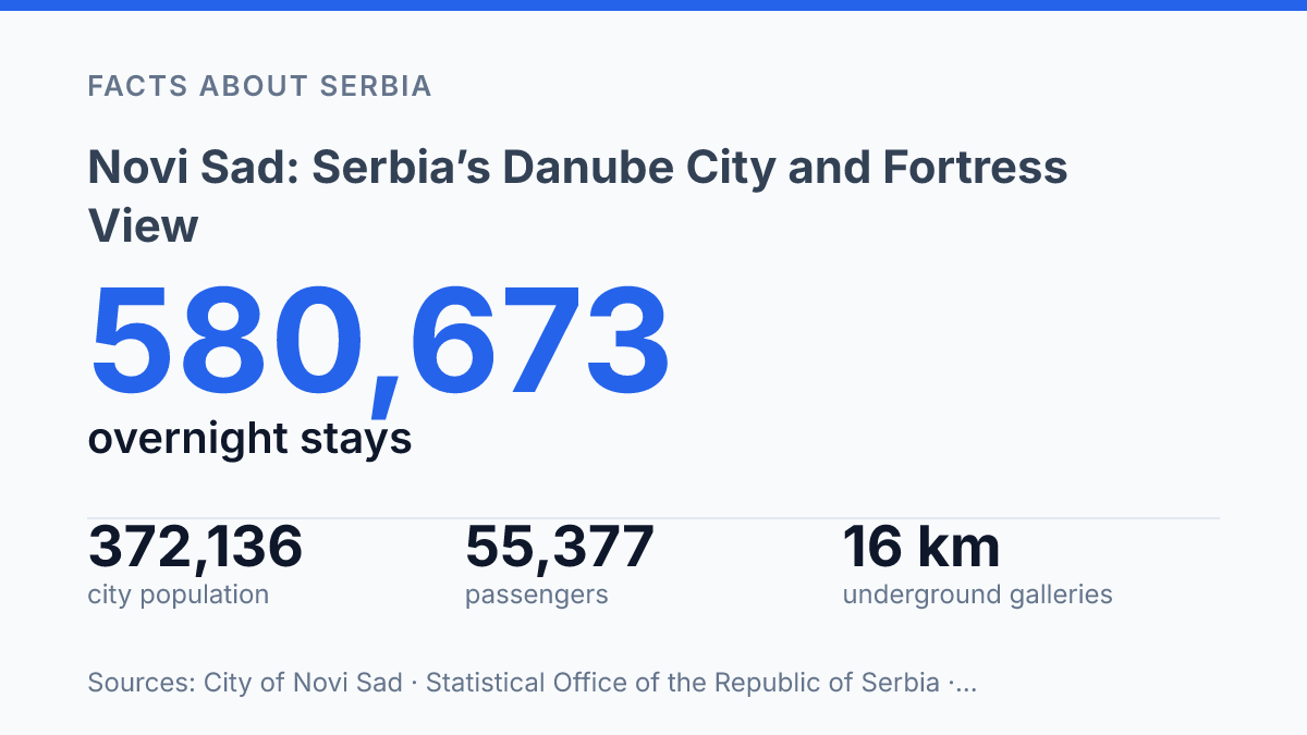
The river still carries visitors in a literal sense. In 2024, the passenger port received 403 ships, and 55,377 passengers disembarked, according to city and port-management data. Those numbers show that the riverfront is not a backdrop. In my view, it’s the main reason the city makes sense so quickly to visitors.
Petrovaradin Fortress and its tunnel network
The fortress gives you the city’s postcard view, but its most revealing feature is hidden under your feet. Petrovaradin Fortress sits on a riverside bluff opposite the old quarter. The first impression is pure theatre: roofs below, river light. A clock tower that seems made for photographs.
That view matters. But it can distract you from the point of the place.
Much of the complex dates to the 17th and 18th centuries, when height, stone, angles, and depth mattered more than beauty. The foundation stone was laid on 18 October 1692, according to the local Tourism Organisation. The fortress grew as a defensive machine rather than a scenic monument. In my honest opinion, that contrast is what makes it the city’s strongest landmark.
The clock tower is the part most visitors remember first. Its reversed hands are the detail that sticks: the large hand shows hours. The small hand shows minutes, making the time easier to read from a distance.
It’s charming now, almost playful. Yet even that landmark belonged to a place designed for control, warning, and visibility.
Beneath the walls, the tone changes fast. The underground military galleries run for more than 16 kilometres, with a four-storey system completed in 1783. Only about 1 kilometre is usually open to visitors, and access is with a professional guide from the city museum.
That limit is part of the experience. You don’t get a theme-park version of the tunnels. You get a controlled glimpse of a structure built to survive pressure.
This is why the fortress dominates the city’s identity. It isn’t just the best viewpoint across the river.
It’s a reminder that the most photogenic place here was built for hard use. The hidden passages make that clear in a way the skyline alone never could.
Stari Grad’s churches, square, and civic architecture
The city’s most formal public face is not on the heights at all. It gathers around Liberty Square in Stari Grad, across the Danube from Petrovaradin. This old quarter feels calmer than the viewpoint side of the city.
That quiet can mislead you. The ceremonial weight is here.
At the square’s edge, the Gothic Revival Name of Mary Church gives the centre its sharpest vertical line. The local tourism organisation records its construction between 1893 and 1895, with a 73-metre tower that turns a compact square into a landmark you can read from several approaches.
It isn’t a cathedral, though visitors often assume it is. That mismatch adds to its pull.
Facing the square, the neo-Renaissance City Hall supplies the civic counterweight. Built in 1894, according to the same local tourism source, it has the balance and authority of a municipal building designed to project confidence. In my humble opinion, that contrast matters more than any single façade: church spire on one side, administrative order on the other, and daily city life moving between them.
Stari Grad works best when you don’t treat it as a checklist. The point isn’t to name every institution or decorative frontage. The old quarter’s strength lies in how a few public buildings frame the city’s identity without shouting for attention.
You feel the difference after crossing back from the riverfront drama. The fortress side gives you height, military memory, and spectacle. Stari Grad gives you civic space, street-level scale.
The architecture of a city that wanted to look official, European, and self-possessed. It’s quieter, yes. But it’s not secondary.
Why the city’s split layout matters to visitors
A single river crossing can flip the visit from roofline-level panorama to pavement-level detail in minutes. What looks like one compact city is really two experiences stacked across a river… and that split is the whole point.
The bluff gives distance. The old quarter gives contact.
From the bluff, the city reads like a diagram: water, bridges, roofs, towers, blocks. Down on the flat streets, that neat picture breaks into façades, doorways, courtyards, and corner views.
The upper view gives order. The lower walk gives texture.
That shift matters more now that visitor demand has grown. In 2024, the city recorded around 240,000 tourist arrivals and 580,673 overnight stays, according to the Statistical Office of the Republic of Serbia.
Those numbers don’t just mean more hotel rooms filled. They mean more people are trying to fit both banks into one short stay.
The Danube does the organizing here. It frames the fortress side, pulls the eye toward the old quarter, and turns the bridges into part of the historic experience rather than mere infrastructure. Instead of cutting the place in half, the river creates a sequence.
You feel that sequence best when you pair height with street level in the same outing. Start above the water, cross over, then slow down among the civic façades. Reverse the order and the same pieces tell a different story.
That same year, the Serbian government counted three river bridges and announced plans for three more. A separate pedestrian-and-cycle bridge proposal lists a 12-metre width and a 437.6-metre structural span. The practical point is clear: the city’s identity depends on movement across the water, not just views from either bank.
In my view, the split layout is the city’s best orientation tool, not a complication. If you only stay on one side, you get half the argument.
Cross the river. The place starts to make sense.
Why the crossing matters more than the view
Treat the river crossing as part of the visit, not dead time between sights. Start near Liberty Square, then cross toward Petrovaradin Fortress late in the day. The city changes when the sun hits the rock.
The next version of this place will make that movement even more central. In 2024, officials spoke of three existing bridges and three more planned, including a pedestrian-and-cycle bridge with a 437.6-metre structural span.
More crossings will help. They may also soften the drama that makes the city memorable.
In my humble opinion, don’t rush the split layout. Stand on one bank and look back at the other.
That distance is not an inconvenience. It’s the city’s clearest lesson.
Frequently Asked Questions
Q: What is Novi Sad best known for?
A: Novi Sad is known for its Danube setting and the hilltop Petrovaradin Fortress. The contrast is the appeal: one side gives you river views, the other gives you a hard-edged historic fort with a clock tower and tunnel network. In my view, that mix matters more than any single landmark.
Q: Is Novi Sad worth visiting for one day?
A: Yes, a day trip works if you want a focused visit. You can see the fortress, cross into Stari Grad, and still get a sense of the city’s layout without rushing every stop. But if you like architecture and long river walks, one day will feel tight.
Q: How old is Petrovaradin Fortress in Novi Sad?
A: Much of Petrovaradin Fortress dates to the 17th and 18th centuries. That age shows in the stonework, the tunnels. The way the site still dominates the bluff above the Danube. It feels defensive, not decorative.
Q: What can you see in Stari Grad across from the fortress?
A: Stari Grad holds the old city center across the river. The standout sights are the Gothic Revival Name of Mary Church and the neo-Renaissance City Hall. The area feels more formal than the fortress side. That contrast is part of the draw.
Q: Does Novi Sad have good river views?
A: Yes, the Danube is central to the whole experience. The best perspective comes from the riverside bluff above the water, where you get a wide view of the city and the fortress in one frame. In my honest opinion, that’s the view people remember long after the rest fades.