
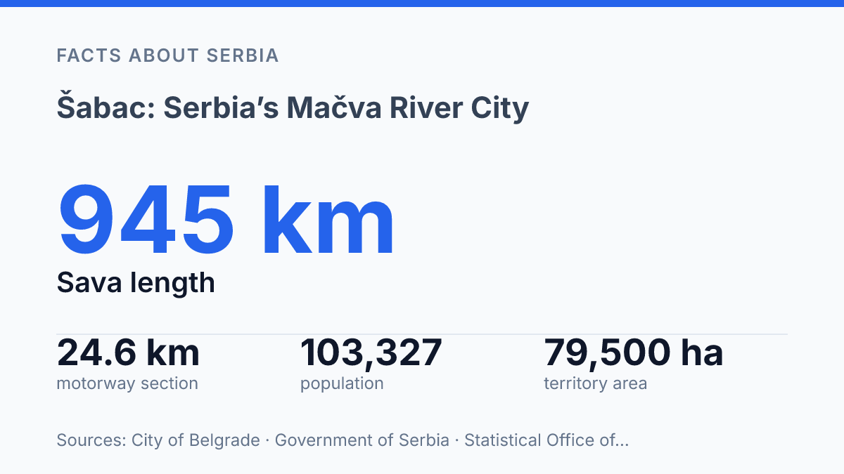
Šabac holds nearly 39.9% of Mačva District’s people, but its real power starts at the Sava’s right bank. The river runs 945 km, with 207 km in Serbia. This city sits on one of its practical urban edges.
The location is exact: 44°46′ N, 19°14′ E, just 80 m above sea level. Geography isn’t background here.
It explains trade, fields, roads. The way visitors read the place.
Mačva looks flat on a map. It isn’t simple. Farms cover 88% of the city’s territory, tying the urban centre to a working plain, not a postcard countryside.
Access changed fast too. On 14 October 2023, a new motorway and Sava bridge shortened the approach from Ruma. In my honest opinion, that matters more than another pretty river description. This guide treats the city as a gateway: riverbank first, district hub next, agricultural plain always in view.
Where Šabac sits on the Sava
Few Serbian cities have a river position as literal as this: Šabac stands on the right bank of the Sava, at the northern edge of western Serbia. Its map coordinates, 44°46′ N and 19°14′ E, put it low on the plain at about 80 metres above sea level. That height matters less as trivia than as a clue: this is a city built to face water, crossings, and flat routes.
The Sava River is not scenery here. It has long shaped where people moved, where settlements took hold, and where goods could pass with less friction. According to City of Belgrade Facts about Belgrade, the Sava runs 945 km in total, with 207 km of its course in Serbia.
Access is the reward. It comes with a catch. A border river can act like a road in one period and a barrier in another.
That tension still colours the city’s identity. The water gives status. It also reminds you that movement here has always depended on where crossing was possible.
Modern transport keeps proving the same point. The Ruma–Šabac motorway and its Sava bridge opened on 14 October 2023, giving drivers a faster link across the river toward Srem and the Belgrade corridor. New asphalt changes travel times.
It doesn’t erase the older geography. It just makes the old crossing logic visible again.
In my view, the clearest way to understand the city is as a river-facing place first. An inland Serbian city second.
You see it in the way roads, trade, and regional belonging all bend toward the Sava. The river gives the place reach… and also gives it its edge.
Šabac and the Mačva District
One city accounts for 39.9% of Mačva District’s residents. It still reads as a regional command point rather than a national metropolis.
That gap matters. It explains why the city’s civic role carries more weight than its skyline or size might suggest.
Šabac is the administrative centre of the Mačva District. That means district institutions, public services, and coordination functions gather here instead of being spread evenly across the surrounding area. For people in smaller municipalities, the city is where many official routes lead.
Numbers make that role concrete. As of 2025, the Statistical Office of the Republic of Serbia estimated the city’s population at 103,327, compared with 259,101 for the whole district. Put plainly, about four in ten district residents are tied to one urban centre.
Mačva matters in western Serbia because it isn’t just a loose geographic label. It is an administrative district, a planning unit.
A practical frame for local governance. Decisions about services, infrastructure, schooling, health access, and inter-municipal coordination all become easier to understand when you see the city as the district seat.
That civic weight comes with a useful tension. District-level importance doesn’t automatically make the city one of Serbia’s biggest urban centres. It doesn’t need to. In my honest opinion, the more revealing point is that it performs a capital-like role for its immediate area without having the scale, pressure, or anonymity of a much larger Serbian city.
So the city’s importance is relational. It sits at the top of Mačva’s local hierarchy, not because it overwhelms the map, but because the wider district depends on it for administration, services, and urban gravity.
Why the Mačva plain matters
On the city’s own territory, farmland takes up 88% of the land, according to the GIZ DKTI Programme’s local biomass logistics study. That figure explains why the city never developed as just a river stop. Its hinterland gave it a job: collect, trade, mill, store, and serve the produce of a wide plain.
Šabac is the traditional centre of Mačva. That title isn’t ceremonial.
The region’s fertility made the city useful to villages around it, not separate from them. Across Mačva District, the same study records 226,513 hectares of agricultural land out of 326,800 hectares total, with 161,343 hectares classed as arable.
By the nineteenth century, the logic of a market town here was easy to read. Grain, livestock, fruit, and other farm goods needed a place where rural production could meet merchants, services, and transport. The city filled that role because the plain kept sending value toward it.
Flat land also changed how people settled. Look away from the river edge and the pattern starts to make sense: villages could spread across level ground, roads could run straighter, and farms could sit close to town markets.
The river pulled goods outward. The plain pulled food inward.
But the same geography carried a cost. A fertile plain feeds people. It doesn’t protect them like ridges, gorges, or hilltop sites can.
Growth and exposure came together. That mix helps explain why this area has always been both productive and vulnerable.
In my humble opinion, the plain matters most because it made the city practical before it made it prominent. Without Mačva’s fields behind it, the river edge would still matter. The city’s purpose would be thinner.
What visitors should know first
The quickest way to misread Šabac is to see the office buildings before the river and fields. It does handle official business for the area. The sharper story starts where the Sava’s movement meets Mačva’s flat, productive ground.
That mix explains the visitor experience better than any checklist. The city feels practical rather than ornamental: a place shaped by trade, farms, road access, river edges. The need to connect smaller settlements to a larger urban centre.
Use it as a clear gateway to western Serbia and Mačva, not just as a stop with a municipal function. In my view, that is the mistake many first-time visitors make, because the city’s identity comes from the Sava and the surrounding plain working together.
Access now reinforces that role. According to PE Roads of Serbia, the 54.5 km Šabac–Loznica expressway opened to traffic on 30 December 2024, giving westbound travel a cleaner line through the region.
That doesn’t turn the city into a highway stop, though. It makes its gateway role easier to feel when you arrive, move on, or loop back.
Read the city through that double lens. River first, plain second. Administration only makes sense after those two forces are in view.
What the new roads change for this river city
The next honest question isn’t what the city has, but how fast its role changes now that the road map has caught up. The expressway to Loznica opened on 30 December 2024, adding 54.5 km of faster movement west.
That gives visitors a cleaner route. It also gives the Mačva plain a bigger audience.
Don’t treat the riverfront, the fields. The new asphalt as separate stories.
They now press on each other. A weekend stop can turn into a regional base, but only if you look beyond the centre and read the land around it. In my humble opinion, the smartest visit starts with a map, not a checklist.
Frequently Asked Questions
Q: Where is Šabac located in Serbia?
A: Šabac sits in western Serbia on the right bank of the Sava River. That spot matters because it puts the city at the edge of the fertile Mačva region, not deep inland. It has always shaped how the city grew.
Q: What is Šabac known for?
A: Šabac is known as the traditional center of the Mačva region. It also serves as the administrative centre of the Mačva District. In my view, that mix of regional importance and river access gives it more weight than its size might suggest.
Q: Is Šabac the capital of Mačva District?
A: Yes. Šabac is the administrative centre of the Mačva District in western Serbia. That makes it the district’s main hub for local government and regional administration.
Q: What river is Šabac on?
A: Šabac is on the right bank of the Sava River. That detail is more than a map fact. It explains why the city has long been tied to trade and movement. River cities don’t stay small by accident… and Šabac is a good example.
Q: Why is Šabac important in the Mačva region?
A: Šabac matters because it sits at the center of Mačva, a fertile agricultural region in western Serbia. The city connects local administration with the surrounding countryside. That combination gives it influence that goes beyond the city limits.